GeoSpy AI
Plataforma impulsada por IA para geolocalización precisa y análisis espacial interpretando los píxeles de imágenes sin metadatos.
Comunidad:
Descripción del Producto
¿Qué es GeoSpy AI?
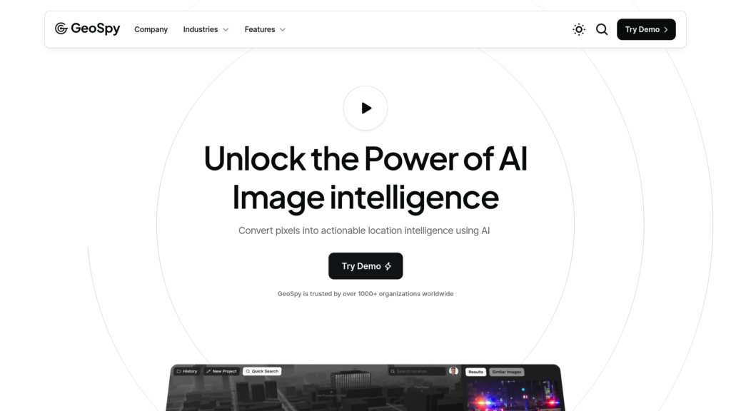
GeoSpy AI es una plataforma avanzada de inteligencia artificial diseñada para determinar la ubicación geográfica de imágenes únicamente analizando sus datos de píxeles. Aprovecha modelos de deep learning entrenados con millones de fotos geolocalizadas para identificar señales visuales sutiles como monumentos, vegetación, estilos arquitectónicos y características ambientales que los humanos no pueden detectar fácilmente. Esta capacidad permite una estimación rápida y precisa de ubicaciones, apoyando aplicaciones en fuerzas de seguridad, periodismo, monitoreo ambiental, planificación urbana e inteligencia de fuentes abiertas (OSINT). GeoSpy AI ofrece versiones gratuitas y profesionales, con funciones escalables adaptadas tanto para usuarios casuales como para agencias especializadas.
Características Principales
Geolocalización basada en píxeles
Utiliza IA para analizar los píxeles de la imagen y extraer características geográficas únicas, permitiendo una predicción precisa de la ubicación sin depender de metadatos.
Análisis de imágenes en tiempo real
Procesa grandes lotes de fotos rápidamente, entregando estimaciones de ubicación y resúmenes detallados en segundos.
Paneles y reportes personalizables
Ofrece interfaces intuitivas con vistas personalizables y reportes detallados para apoyar la toma de decisiones y la colaboración.
Amplio soporte de aplicaciones
Admite diversos casos de uso, incluyendo fuerzas de seguridad, OSINT, periodismo, investigación ambiental y viajes.
Alta precisión con aprendizaje continuo
Mejora la precisión de la geolocalización con el tiempo aprendiendo de conjuntos de datos en expansión y retroalimentación de usuarios.
Enfoque en privacidad y seguridad
Garantiza que los datos e imágenes de los usuarios permanezcan privados y seguros, con directrices éticas para prevenir el mal uso.
Casos de Uso
- Fuerzas de seguridad e investigaciones : Ayuda a las agencias a verificar rápidamente ubicaciones de imágenes para apoyar investigaciones criminales y análisis de amenazas.
- Inteligencia de fuentes abiertas (OSINT) : Permite a los analistas autenticar y geolocalizar imágenes para la recopilación y verificación de inteligencia.
- Periodismo y verificación de medios : Asiste a periodistas en confirmar la autenticidad y el origen de imágenes para prevenir la desinformación.
- Monitoreo ambiental : Rastrea cambios geográficos a lo largo del tiempo analizando imágenes satelitales y a nivel del suelo para investigación.
- Planificación urbana e infraestructura : Apoya a urbanistas con información espacial derivada del análisis de imágenes para una mejor toma de decisiones.
- Viajes y uso personal : Permite a viajeros y aficionados descubrir y verificar ubicaciones de fotos con fines educativos y de entretenimiento.
Preguntas Frecuentes
Alternativas a GeoSpy AI
Dries Depoorter (Driesdepoorter.be)
Plataforma artística que explora la IA, la vigilancia, la privacidad y las redes sociales a través de instalaciones digitales provocadoras y proyectos de software.
Flora Incognita
Una aplicación de identificación de plantas que permite el reconocimiento rápido de más de 16.000 especies de plantas vasculares en todo el mundo mediante un análisis fotográfico intuitivo.
Project Aria
Una plataforma de investigación diseñada por Meta para recopilar datos egocéntricos multimodales a través de gafas equipadas con sensores, impulsando tecnologías de IA espacial y realidad aumentada.
SocialFinder.ai
Plataforma impulsada por IA para encontrar a cualquier persona en línea usando una sola foto, escaneando redes sociales y datos web con reconocimiento facial y geolocalización.
RealEye.io
Plataforma web de seguimiento ocular y neuromarketing que permite la investigación remota del comportamiento del usuario vía webcam con análisis en tiempo real.
MyLens AI
Plataforma potenciada por IA que transforma ideas y contenido visual en visualizaciones e ideas claras y accionables.
Pl@ntNet
Plataforma de ciencia ciudadana impulsada por IA para la identificación de plantas y el monitoreo de la biodiversidad mediante reconocimiento de especies por foto.
PlantIn
Aplicación de identificación y cuidado de plantas impulsada por IA, con planes personalizados, diagnóstico de enfermedades y soporte de botánicos expertos.
Analítica del Sitio Web de GeoSpy AI
🇯🇵 JP: 100%